Property Record
722 Highway 211 Nw, Winder, GA 30680

This Property Is For Sale
NEARBY LISTINGS FOR SALE OR LEASE
Property Detail
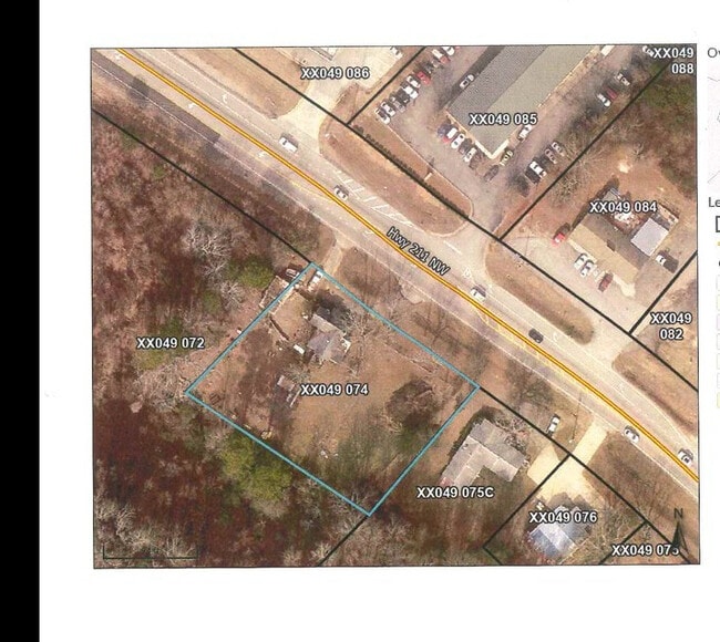
722 Highway 211 Nw
Atlanta-Sandy Springs-Roswell, GA
Pointe South
XX049-074
Barrow
Sfr
Georgia
X
0.78 AC
13013C0044D
Barrow County
1,092 SF
Atlanta
DEMOGRAPHICS near 722 Highway 211 Nw
1 Mile
3 Mile
5 Mile
2024 Total Population
2,668
20,618
57,681
2029 Population
3,011
23,215
65,672
Pop Growth 2024-2029
+ 12.86%
+ 12.60%
+ 13.85%
Average Age
39
38
38
2024 Total Households
869
7,094
20,142
HH Growth 2024-2029
+ 13.00%
+ 12.64%
+ 13.96%
Median Household Inc
$74,264
$65,862
$70,755
Avg Household Size
2.80
2.80
2.80
2024 Avg HH Vehicles
2.00
2.00
2.00
Median Home Value
$298,025
$281,769
$300,900
Median Year Built
1998
1994
1998
Nearby Places
Map Layers
Map Styles
 Street
 Aerial
- Restaurants
- Banks
- Shops
- Fitness
- Groceries
Nearby Properties
Address
Land Use
TOTAL SIZE
Lot Size
Zoning
Address
Land Use
TOTAL SIZE
Lot Size
Zoning
222,481 SF
23.21 AC
M-1
Address
Land Use
TOTAL SIZE
Lot Size
Zoning
165,737 SF
124.90 AC
G
Address
Land Use
TOTAL SIZE
Lot Size
Zoning
105,850 SF
61 AC
G
Address
Land Use
TOTAL SIZE
Lot Size
Zoning
690,427 SF
156.03 AC
M-1
Address
Land Use
TOTAL SIZE
Lot Size
Zoning
50,000 SF
29 AC
G
Address
Land Use
TOTAL SIZE
Lot Size
Zoning
89,684 SF
64.92 AC
B-2
Address
Land Use
TOTAL SIZE
Lot Size
Zoning
38,000 SF
362.35 AC
G,R-1A
Address
Land Use
TOTAL SIZE
Lot Size
Zoning
189,400 SF
24.79 AC
C-2
Address
Land Use
TOTAL SIZE
Lot Size
Zoning
233,462 SF
25.22 AC
C-2
Address
Land Use
TOTAL SIZE
Lot Size
Zoning
137,200 SF
20 AC
M-2
Address
Land Use
TOTAL SIZE
Lot Size
Zoning
24,188 SF
40.70 AC
M-1
Address
Land Use
TOTAL SIZE
Lot Size
Zoning
2,160 SF
23.93 AC
B-1
Address
Land Use
TOTAL SIZE
Lot Size
Zoning
14,800 SF
57.87 AC
M-1
Address
Land Use
TOTAL SIZE
Lot Size
Zoning
69,285 SF
53.11 AC
M-2
Address
Land Use
TOTAL SIZE
Lot Size
Zoning
59,898 SF
38.86 AC
M-1
Address
Land Use
TOTAL SIZE
Lot Size
Zoning
76,768 SF
24.98 AC
R-1
Address
Land Use
TOTAL SIZE
Lot Size
Zoning
22,500 SF
10.52 AC
M-1
Address
Land Use
TOTAL SIZE
Lot Size
Zoning
3,116 SF
20.98 AC
G
Address
Land Use
TOTAL SIZE
Lot Size
Zoning
18,750 SF
4.63 AC
M-1
Address
Land Use
TOTAL SIZE
Lot Size
Zoning
325.04 AC
R-3
Address
Land Use
TOTAL SIZE
Lot Size
Zoning
71,300 SF
13.82 AC
M-2
Address
Land Use
TOTAL SIZE
Lot Size
Zoning
56,250 SF
4.69 AC
M-1
Address
Land Use
TOTAL SIZE
Lot Size
Zoning
13,000 SF
3.31 AC
B-1
Address
Land Use
TOTAL SIZE
Lot Size
Zoning
24,400 SF
20 AC
M-2
Address
Land Use
TOTAL SIZE
Lot Size
Zoning
20,307 SF
5.11 AC
G
Address
Land Use
TOTAL SIZE
Lot Size
Zoning
60,307 SF
33.41 AC
AG
Address
Land Use
TOTAL SIZE
Lot Size
Zoning
5,400 SF
8 AC
G
Address
Land Use
TOTAL SIZE
Lot Size
Zoning
387.40 AC
AG
Address
Land Use
TOTAL SIZE
Lot Size
Zoning
45,736 SF
6.69 AC
G
Address
Land Use
TOTAL SIZE
Lot Size
Zoning
2,132 SF
4.42 AC
B-1
The World's #1 Commercial Real Estate Marketplace
Connect with us
© 2026 CoStar Group
The information above has been obtained from sources believed reliable. While we do not doubt its accuracy we have not verified it and make no guarantee, warranty or representation about it. It is your responsibility to independently confirm its accuracy and completeness. Any projections, opinions, assumptions, or estimates used are for example only and do not represent the current or future performance of the property. The value of this transaction to you depends on tax and other factors which should be evaluated by your tax, financial, and legal advisors. You and your advisors should conduct a careful, independent investigation of the property to determine to your satisfaction the suitability of the property for your needs.